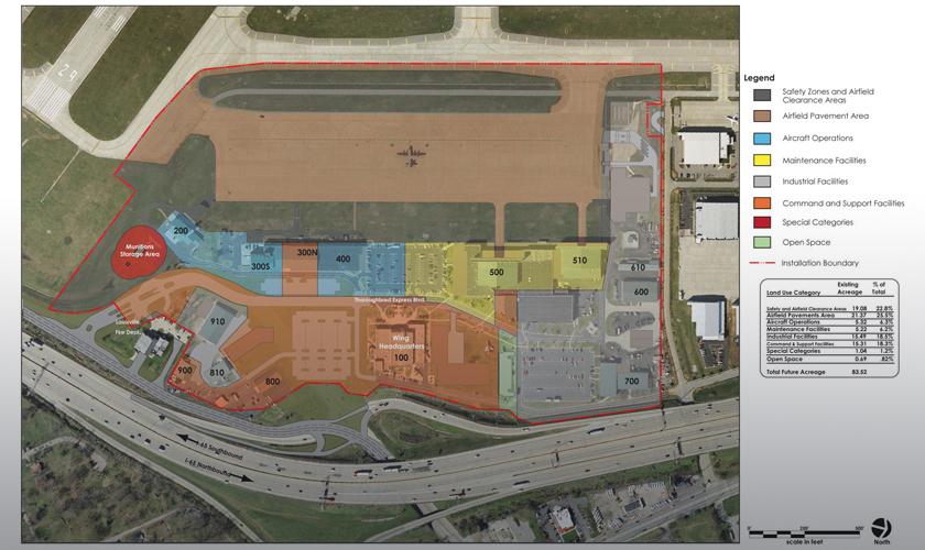
The 123rd Airlift Wing of the Kentucky Air National Guard (ANG) provides airlift for military and humanitarian efforts worldwide. Equipped with C-130H aircraft, the Wing also has a mission that is unique to the Air Guard – Critical Response, which requires mobilization to establish airfield operations and support anywhere in the world, such as the re-establishment of airfield operations following the 2010 Haiti earthquake.
GRW prepared the base’s first installation development plan (IDP) since relocating to the south side of the Louisville International Airport in the mid 1990s. The IDP allows the base to undertake a variety of future aircraft configurations and mission options, and accommodate the addition of the critical response mission. Prepared as a web-based document, the IDP can be easily updated by Guard personnel as their mission changes and planned facilities are built.
Using in-house aerial photography, mapping and GIS capabilities, GRW developed a Common Installation Picture (CIP) for the Wing. The CIP is a series of geographically-referenced maps, showing all facilities and infrastructure, which were integrated using a facility inventory system into a base-wide Geographic Information System. The CIP provides rapid access to databases for detailed information on real property, utility systems, real estate and other assets vital to the base’s mission capability.


 Kentucky ANG Installation Development Plan and Common Installation Picture, Louisville, KY